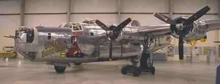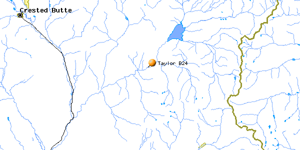
Taylor Park B-24
| Name | Taylor Park B-24 |
| CAP data | 3846N 10640W UNK 44,B-24,UNK,NOT VIS FROM AIR,12.5 |
| GPS coords | 38 45' 55.8" 106 39' 15.0" by GPS. |
| GPS decimal | 38.76550 106.65417 |
| UTM | |
| Datum used | NAD 27 |
| County | Gunnison County, CO. |
July 19, 1943
S/N 41-29027
 |
| Photo by John Sepp. Courtesy of the Pima Air and Space Museum |

(Click on pictures to get enlarged image)
 |
| 2 main gear, memorial plaque, flowers. |
The wreck cause: Loss of control in cloud and in-flight breakup of the aircraft. All aboard killed.
Casualties: 2nd Lt. James H. Allen
2nd Lt. Sherod D. Derryberry, Jr
2nd Lt. William M. Statler
2nd Lt. Billy B. Thompson
Major Robert C. Quine
S/Sgt Romeo P. Berube
S/Sgt James W. Beazley
S/Sgt James F. Emerich
S/Sgt Rocci A. Greco
S/Sgt Richard D. Yost
Site Description:.
Wreckage is about 200' above the Taylor River road about 400 yards upstream
from the edge of Lodgepole NFS campground. Site contains memorial placque,
landing gear struts, misc. engine mount piping, some exhaust manifold piping
and some melted aluminum. Appears that all other wreckage including engines
was recovered by Army. Recovery would have been fairly simple to winch debris
down to the road to be hauled away.Cause of crash was structural breakup
in the air. Aircraft was seen to fall out of the clouds in pieces..
According to the Denver Post for 1 July 2001, Mr. Ray Rossman of the Gunnison National Forest (USDA) was involved with placing the memorial on the 50 th anniversary of the crash. Mr. Rossman's title is "Heritage Resources Manager."
Best route : Wreck is located very close beside Forest Road 742, a paved road that runs down the gorge next to the Taylor River below the Taylor Reservoir Dam. Wreck is perhaps 100' above the road. About 300 yards uphill from the boundary of the Lodgepole NFS campground.
Trips to find the Taylor B-24 (2 more pictures)
Last Modified: 1/1/2008