Pike's Peak C-47
| Name | Pike's Peak C-47 |
| CAP data | 38 51 105 04 |
| GPS coords | 38 53' 38.2" 105d 03' 24.4" |
| GPS decimal | 38.89394 105.05677 (one of the parts found) |
| UTM | |
| Datum used | NAD 27 |
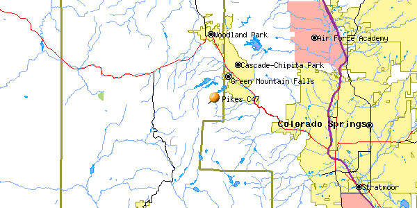
| County | Teller |
14 October, 1947 at 1808 MST
C-47A 42-23503
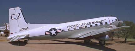 |
| R4D at Pima Museum. Similar to DC-3/C-47
Photo by John Sepp. Courtesy of the Pima Air and Space Museum
|
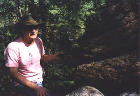 |
| Pete Rawson holds up piece of manifold.
(No other photos turned out) |
CAP wording: None.
The wreck cause: Briefly- Series of mistakes leading to descent 75 miles away from expected position. (See detailed accident report transcript.)
Casualties: S/Sgt Aloyisius S. Kissel (Engineer, Iowa National Guard)
M/Sgt Leo E. Simmons (Passenger, Des Moines Civil Air Patrol)
1st Lt. Jack M. Glider (Passenger, Des Moines CAP)
Survivors: Maj. Robert R. Oliver (Pilot, USAF, major injuries)
Maj. Joseph W. Parks (Co-Pilot, USAF, major injuries)
M/Sgt. John W. Knight (Engineer, Iowa NG, major injuries)
1st Lt. David D. Cleary (Minn. CAP, major injuries) (Last name corrected 1/25/05 from nephew-in-law)
Site Description: When visited on 7 July 2001 it was unclear exactly where the site was. We found some parts of the airplane - most notably half the crankcase for the #1 engine with its serial number but the total number of pieces we found was about 12. These pieces were scattered over a fairly wide area and we had to search pretty hard to find them. The crankcase half was the largest part. Obviously the wreck has been cleaned up and whoever did it left nearly nothing to indicate there had been a wreck there nor was it apparent how the wreck had been removed. Even the tree cover in the area was unclear about where the crash had been since there are several areas where thin aspen has grown but most of them seem to also have a 3' thick pine in them too. We didn't find a spot where any big trees seemed to have been knocked down. The location is about the 10,400' level just to the east and slightly below a large rock outcrop.
Best route : We reached the wreck after parking at a picnic area (38d 54' 05.4" 105d 03' 55.1") by taking a power line service road (hit the road at 38d 54' 03.2" 105d 03' 50.3") to the final pole below slope upon which the wreck used to be. This road transits from just east of the picnic area and makes for easy walking as it curves up and around a valley you don't need to walk through. At the final power pole (the only one the road actually goes to ) turn uphill and follow the spine of the slight ridge up to the coordinates. You'll have to search very, very carefully to find the few parts there.
Info wanted: I'd sure like to know how that wreck was removed. And when.
| Man standing on wreck - front view. | Fuselage side door. | Front and right engine. |
Home Moggie!
Last Modified: 1/1/2008