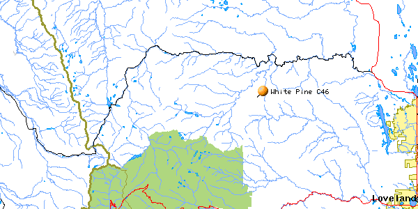
West White Pine Mtn C-46
| Name | West White Pine Mtn C-46 |
| CAP data | 4037N 10528W 16NOV58,C46,N1310N,N SD W WHT PINE MT/MSTLY RMVD,12.5 |
| GPS coords | N40 36 53.8 W105 28 44.8 by GPS (corrected 7-3-2022) |
| GPS decimal | N40.61495 W105.47912 (corrected 7-2-2022) |
| UTM | 459528, 4495881 |
| Datum used | NAD 27 |
| County | Larimer County, CO. |
Nov. 16, 1958
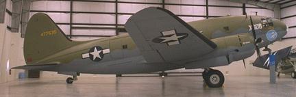
N1301N
Curtiss build # 22480
|
| "Photo by John Sepp. Courtesy of the Pima Air and Space Museum |
(Click on picture to get enlarged image)
 |
 |
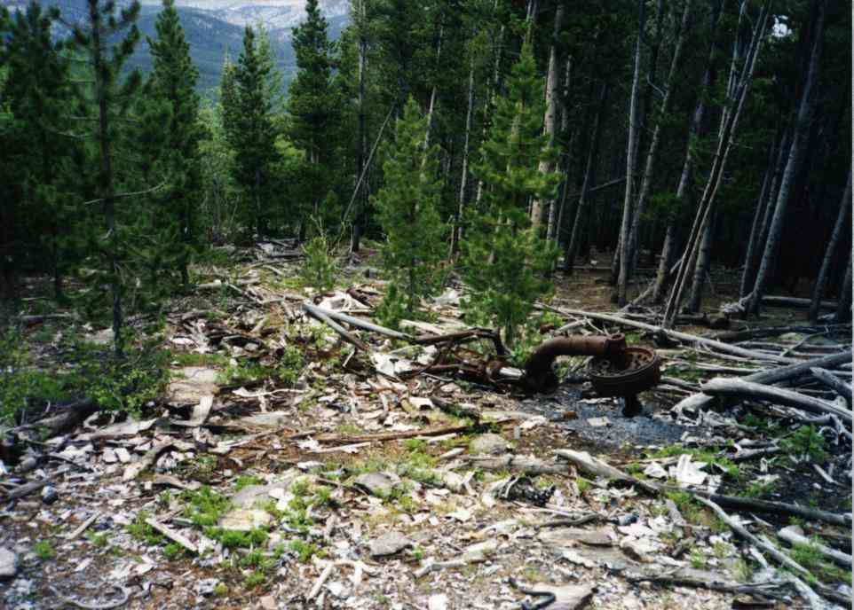 |
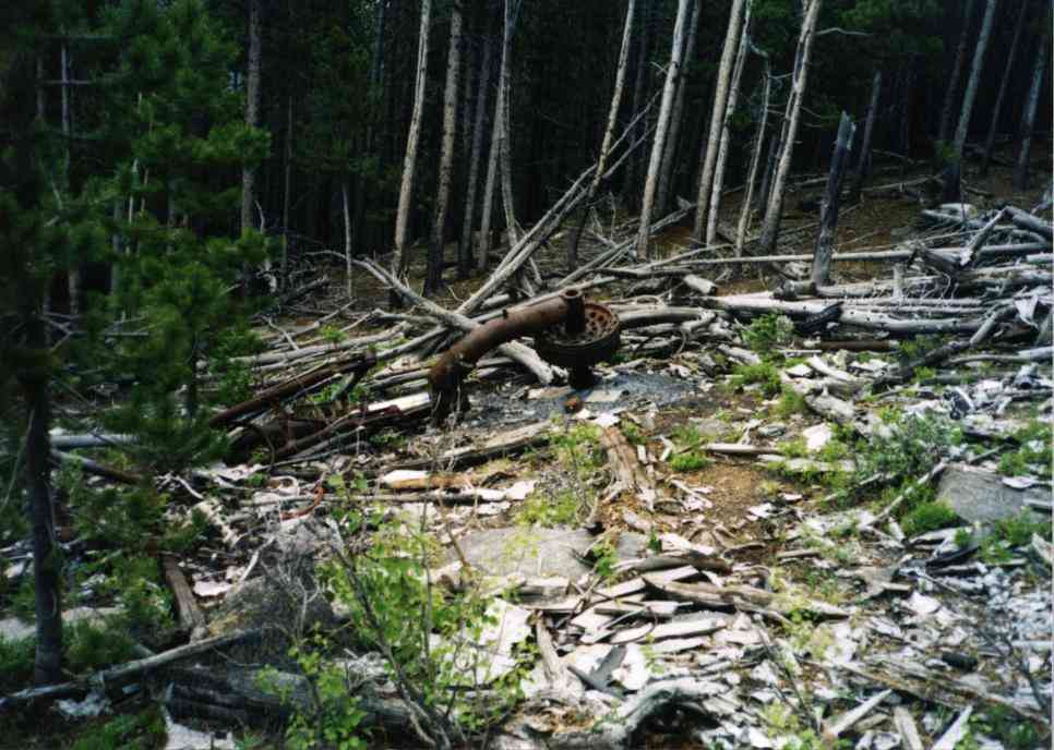
| Site has 1 gear leg (pre-burn) | "scar on the mountain" view from air (pre-burn) | Site looking north (pre-burn) |
 |
 |
|
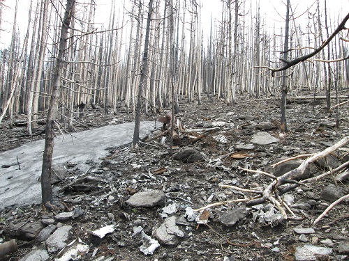
| Gear leg (post-burn) | Site looking north (post-burn) |
 |
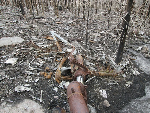 |
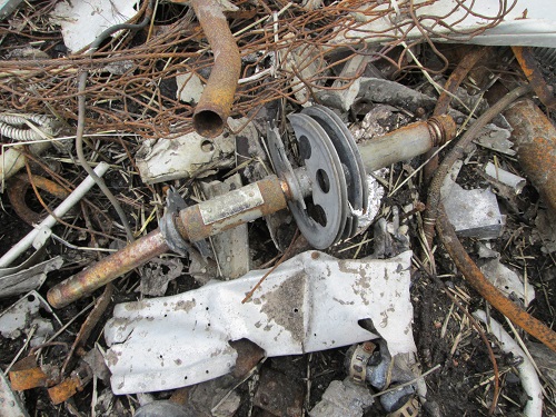
| Pulley (post-burn) | Strut (post-burn) |
 |
|
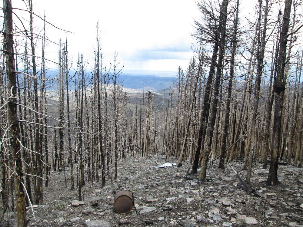
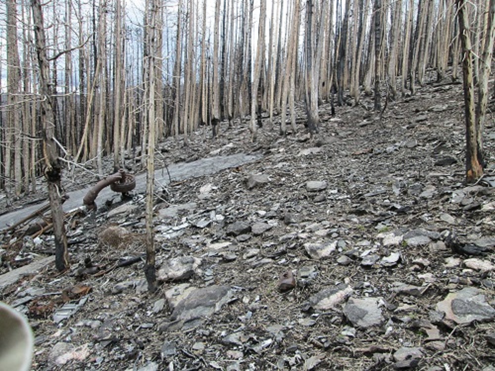
| Wide view (post-burn) |
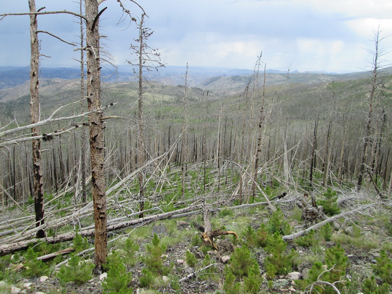
Aug 5, 2012 Note: The High Park Fire of June 2012 burned across this location. It burned all of the north side of White Pine Mtn. The NFS has closed off access to all parts of the burn area until further notice. This includes the Flowers Road portions which run thru the burn area. So the site is inaccessible to even see how the fire affected it.
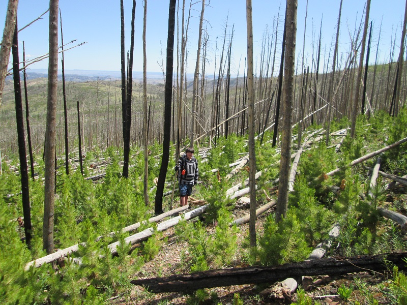
May 2014: The NFS has allowed pedestrian access to the Old Flowers Road but no vehicle access due to road mud and severe erosion in at least one spot. I revisited the site on May 26, 2014 and have added some pictures from that visit. Trip report here.
July 2 2022: Revisit site. Flowers Road is open so can drive to base of the mountain. HOWEVER- now that the burned trees have fallen down, the mountainside is now a horrid tangle of down trees making navigation thru, around, and over them very difficult. In addition, the burn left the footing as mostly rock so between the trees and the rocks travel to the site is quite hazardous in terms of potential injury. We also discovered that my previously posted coordinates were about 150' in error due to having first taken them during the period when the Air Force was deliberately degrading the accurace of GPS position. Coordinates now corrected.
Several pictures of the July 2022 travel conditons-
The wreck cause: Unknown. IFR from Denver to Hill AFB. Nov. 16, 1958
Accident report here says they lost an engine in icing conditions.
Casualties: Pilot Frank L. Courtell, Capitol Airways (Corrected name)
Co-Pilot Calvin Cloud, Capitol Airways
Email note received from the son of the pilot during Feb. 2003:
I have a correction - the name of the pilot was 'Frank LaVern Courtell'. The newspapers, at the time of the crash, printed the wrong name - his wife's nickname was 'Birdy' - they were avid golfers.
It crashed during a snow storm while trying to turn back to denver - or so we were told. But we were also told that the plane was mostly in one piece - they took 4 days just to get to it.
I was only 13 years old when my father died - they probably held back some of the details from me and my younger sister.
I wish I could tell you more - but it was a long time ago.
Thanks - Frank Courtell
Original Site Description:. Opening in the forest with aspens growing thru. Melted aluminum, a landing gear leg, perhaps a fuselage door, piping, tubing, misc bits. (It's entirely possible the plane was in one piece after the crash. I simply have no info about that. - Ron)
Original Best route Easiest way to get there is to take the Pingree Park road from Colo. Hwy 14 (Poudre Canyon). Head south on the PP road to across from the Jack’s Gulch Recreation area. Turn onto the Flowers road headed east. (ROAD CLOSED TO VEHICLES ) Go approximately 2 .6miles. There are two ridges that the road climbs. After the road descends from the second ridge there is a bermed off road leading to the right just as the main road makes a left. (Coords are : 40 37 24.2 N 105 29 05.4 W .) Follow this bermed road first west, then east, then UP to the wrecksite You should be able to find a few scraps of aluminum here and there in the road which probably fell off the trucks as the wreckage was being hauled away. Update May 2014- Air dropped hay has covered much of the burned-off mountain making the trail much more difficult to follow than previously.
July 2022 Best Route- All traces of the previous trails are gone. Go to the top of the third ridge and park. Follow the top of the third ridge as best you can to a saddle which will take you to the main slope of W. White Pine. Follow the GPS to the site as best you can. The ridge top tends to have fewer trees down but the main slope is just ...... a mess. I strongly recommend using a hiking stick to help with balance when crossing over the debris.
Trips to find the C-46 (no pictures)
Thoughts 7/19/2009- After another trip to the site to survey it for the Colorado Aviation Historical Society I got a LOT more interested in the history of the C-46 type airplane. The C-46 was extensively used to fly cargo over The Hump in China. But the plane had some bad behaviors and features such as Curtiss Electric props which had very bad failure modes. And there were some issues with inflight explosions. And of course there was the weather over The Hump itself and the wartime losses were enormous.
Check the loss history of the C-46 for the war years- It appears that the first 650 losses were incurred by the US Army Air Corps (pages 1 thru 6). There were 2500 planes built and the losses were staggering during the war. And the place names they were lost in -exotic.
Then the airplanes were surplussed to cargo carriers and non-US airlines. And the crashes continued to occur in faraway exotic places until over 1000 of the planes are crash reported losses. (pages 1 thru 11)
John Deakin who flew the Confederate/Commerative Air Force's CHINA DOLL C-46 to airshows loved the airplane and wrote about it here.
Others wrote about it here as well.
Home Moggie!

Last Modified: 7/3/2022