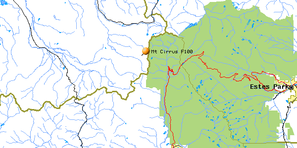
Mt. Cirrus F-100
| Name | Mt. Cirrus F-100 |
| CAP data | 4026N 10553W 30JAN67,F100,SEE*,*AG542015/CIRRUS PK/EMPENNAGE,13. |
| GPS coords | 40 26' 14.9" 105 55' 07.6" (by GPS. Cirque bottom.) |
| GPS decimal | 40.43748 105.91816 |
| UTM | 0422126, 4476509 in UTM . |
| Datum used | NAD 27 |
| County | Jackson County, CO. |
Jan. 30, 1967
(Click on pictures to get enlarged images)
|
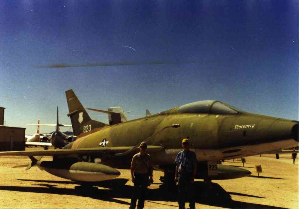
| F-100 at Pima Museum. Visited personally. |
 |
| There are parts all over the rockslide to the right.
I left this flag on my first visit. |
The wreck cause: Flight into terrain hidden in clouds while barrel rolling around lead ship in flight of 2.
Casualties: Lt. Eldon C. Hart, Jr of Rexburg, ID.
Site Description:. Rudder, elevators, wheel with tire assembly,
misc flaps, engine core most visible parts. Cruciform fins for fuel tank,
drogue chute, 20 mm gun, struts etc., also there. Dark colored rockslide
with bright aluminum bits is visible 2.5 mi away from Baker Pass trail near
TH.(Not really on the terrain feature labeled Hart ridge.)Impact on ridge
to NE.
.
Best route : Hike from Baker Pass Trailhead at the top of Jack Creek. Hike east then north along timberline on the cairn-marked trail to the site. A fast hiker should make this in about 2.5 hrs.
First trip to the F-100 (This is one set of stories.)
Second trip to the F-100(This is the same webpage as above. 15 pictures.)
Hart Family visits F-100 crash site August 2000 (This is a different webpage to divide the stories up somewhat. 14 pictures. )
Note: In order to see all the photos, you'll have to download both pages.
Home Moggie!
Last Modified: 1/1/2008