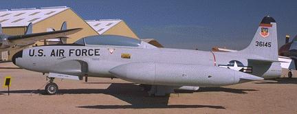
Photo by John Sepp. Courtesy of the Pima Air and Space Museum
Allenspark T-33
| Name | Allenspark T-33 |
| CAP data | 4009N 10531W 1963,UNK,UNK,JET TRAINER/BURNED/MARKED,12.5 |
| GPS coords | N 40d 09min 30.9sec W105d 30min 22.3sec on 9200' contour. |
| GPS decimal | 40.15858 105.50619 |
| UTM | 13T 0456891, 4445271 |
| Datum used | NAD 27 |
| County | Boulder, Near Allenspark, CO. |
|
| Pima Air Museum's T-33
Photo by John Sepp. Courtesy of the Pima Air and Space Museum |
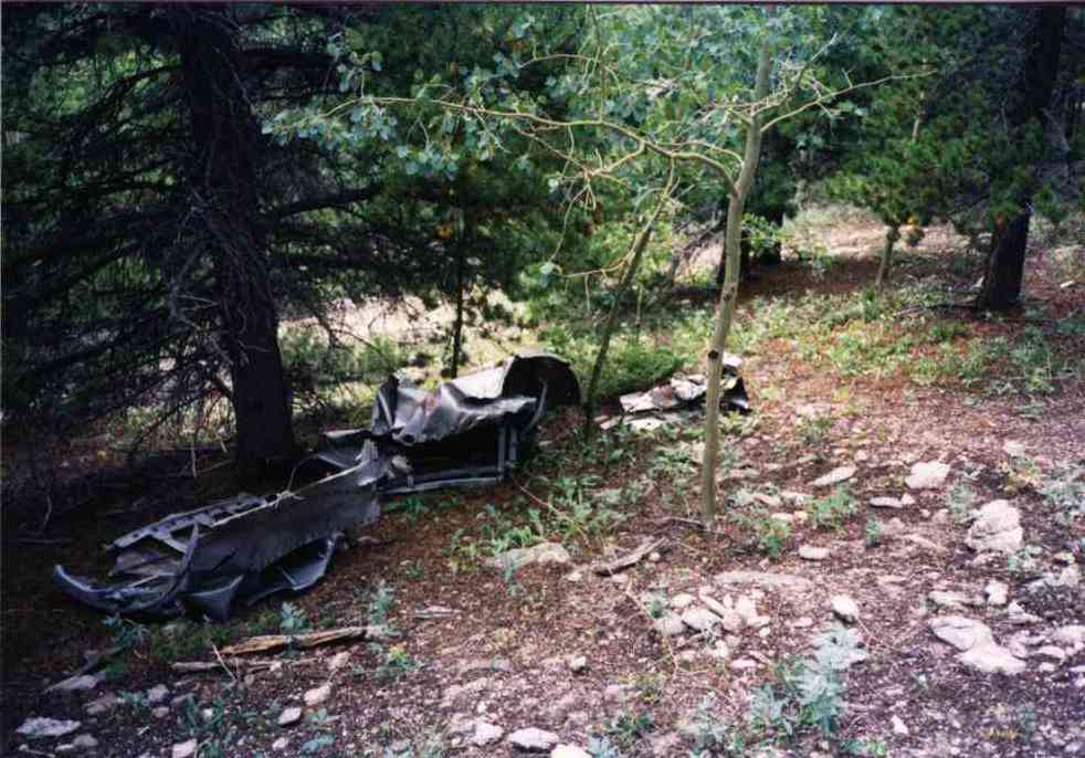 |
| Fuselage remains amongst other things. |
The wreck cause: Uncertain. Flying low and slow near thunderstorm to look over newly purchased land . Both occupants killed.
Casualties: USAF Major Jay. E. Currie
USAF 1st Lt Donald Darby
Site Description:. . Directly west on east facing ridge face from stacks of rocks on flat at 9000' level. Between rock slab vert faces at top of aspen grove. 1/2 wing, exhaust casing, gear struts remain. In the trees a bit below is the tail assembly. Further below is the aircraft radio and a segment of the nose cap. Perhaps other parts are in the area. Red painted X on panels is the Civil Air Patrol marking for a known wreck. Site is fairly close to civilization and makes a nice daytrip.
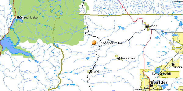
2022 Revised Best route to visit begins by finding Forest Service (FS) road 105 west of Peaceful Valley Campground off of CO 72. Follow it to where FS 202 intersects ( N40.13615 W105.50462 ) go a short ways to FS 203 ( N40.13838 W105.50683 ). If you aren't driving a lifted rock-crawling durable vehicle park someplace along here and plan to hike the rest of the way. There are quite a few gnarly rock ledge obstacles further up. FS 203 leads up to very near the crash site to a dead end with a relatively large turnaround area.
I used to recommend coming in on FS 105 from Bunce School but in 2022 this road has been beaten to death and too much soil has been eroded from around rock obstacles and made this route far worse than coming in from Peaceful Valley/ Camp Dick road. I drove my stock 2001 Jeep Cherokee but hit the skidplate several times and was fearful of getting high-centered many more.
The area is now heavily used by
ATVs and side-by-side vehicles. On 10/15/2022 we encountered 50
(FIFTY!) of them heading up the trail. Weekend visit might be
frustrating because of narrow trails and meeting other vehicles.
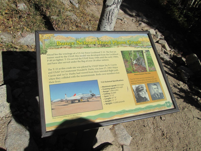
There is an informational display at the point where one has to leave their vehicle and walk the rest of the way on foot.
A reminder- this is Federal land and anything 50 years old or more is protected.
Federal Felony if you are caught removing anything.
| Park here | 40deg 08min 18.3sec, 105d 30m 24.6s |
| 40 08 20.6, 105 30 20.1 | |
| 40 08 31.7, 105 30 25.0 | |
| 40 08 42.1, 105 30 12.8 | |
| 40 08 54.5, 105 30 07.9 | |
| 40 08 55.1, 105 30 08.6 | |
| 40 08 56.2, 105 30 19.8 | |
| 40 09 03.0, 105 30 22.6 | |
| 40 09 11.8, 105 30 31.7 | |
| 40 09 23.1, 105 30 28.6 | |
| Site | 40 09 30.9, 105 30 22.3 |
Trips to find the T-33 and pictures (4 pictures)
Additional new links as of 8/7/2017- http://www.tflcar.com/2015/10/off-road-america-the-road-less-traveled-in-search-of-a-jet-plane-crash-video/
and http://www.jkowners.com/forum/trail-trip-reports/2675-t-33a-plane-crash-trail.html
Home Moggie!
Last Modified:10/16/2022